
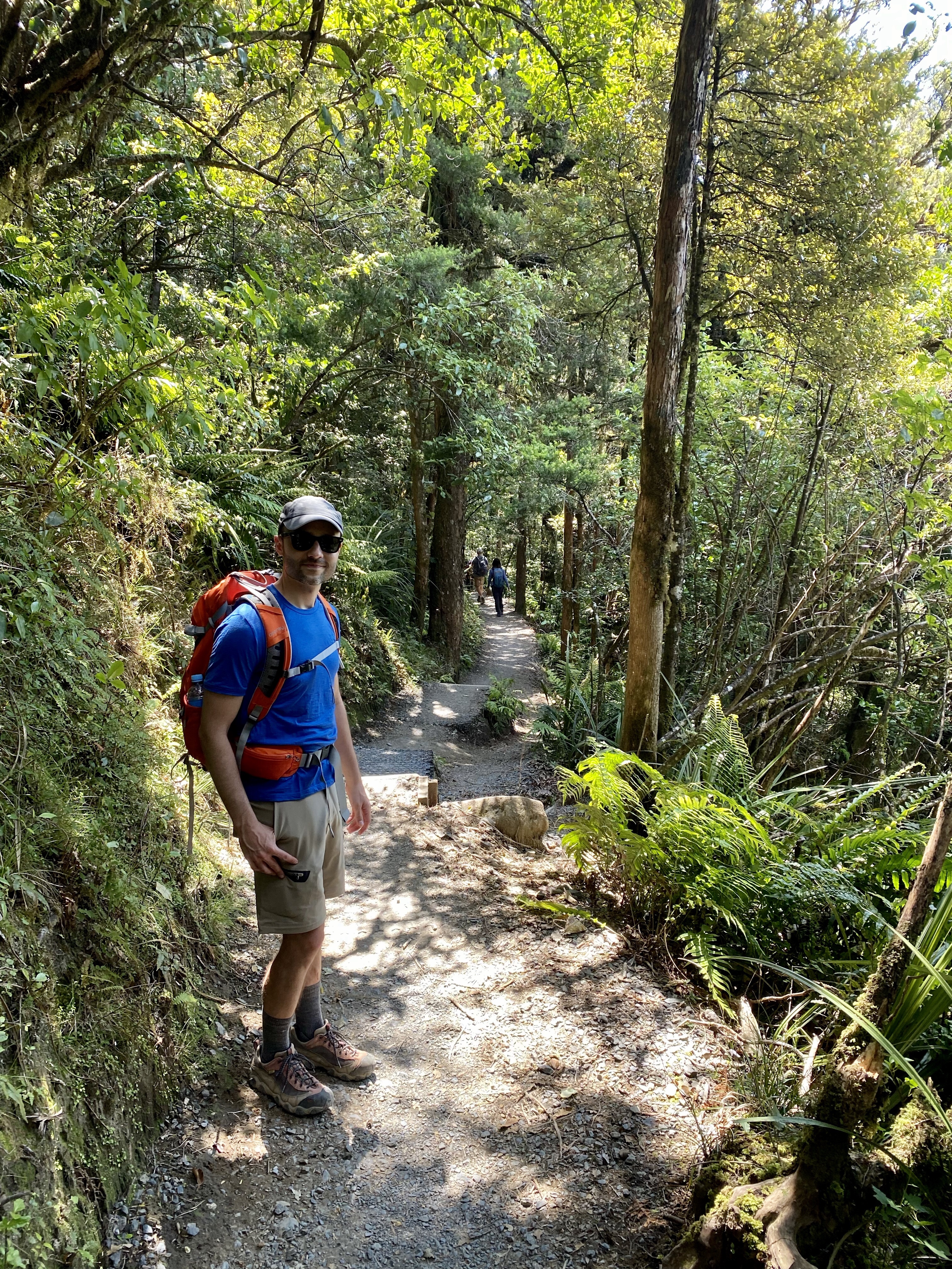
Aside from hanging out with the Hettingers and Kallmeyers, my only agenda item for New Zealand was to go “tramping” (as the locals call hiking) through the Tongariro Alpine Crossing. Touted as one of the best day hikes in New Zealand, the 12-mile trail takes you through a nest of volcanic cones — including the one that stood in for Mount Doom in the Lord of the Rings movies — and, conveniently, is only two hours away from where we’re staying in Rotorua. So while the kids went to a kiwi hatchery, Karl and I headed south for what turned out to be a perfect day of hiking.
We left Rotorua a little after 6am and drove out into a chilly, foggy morning. It made for a very atmospheric drive but also made me nervous about the hike — I didn’t want a repeat of Mount Fuji, where I hiked the whole way in freezing fog with no views!

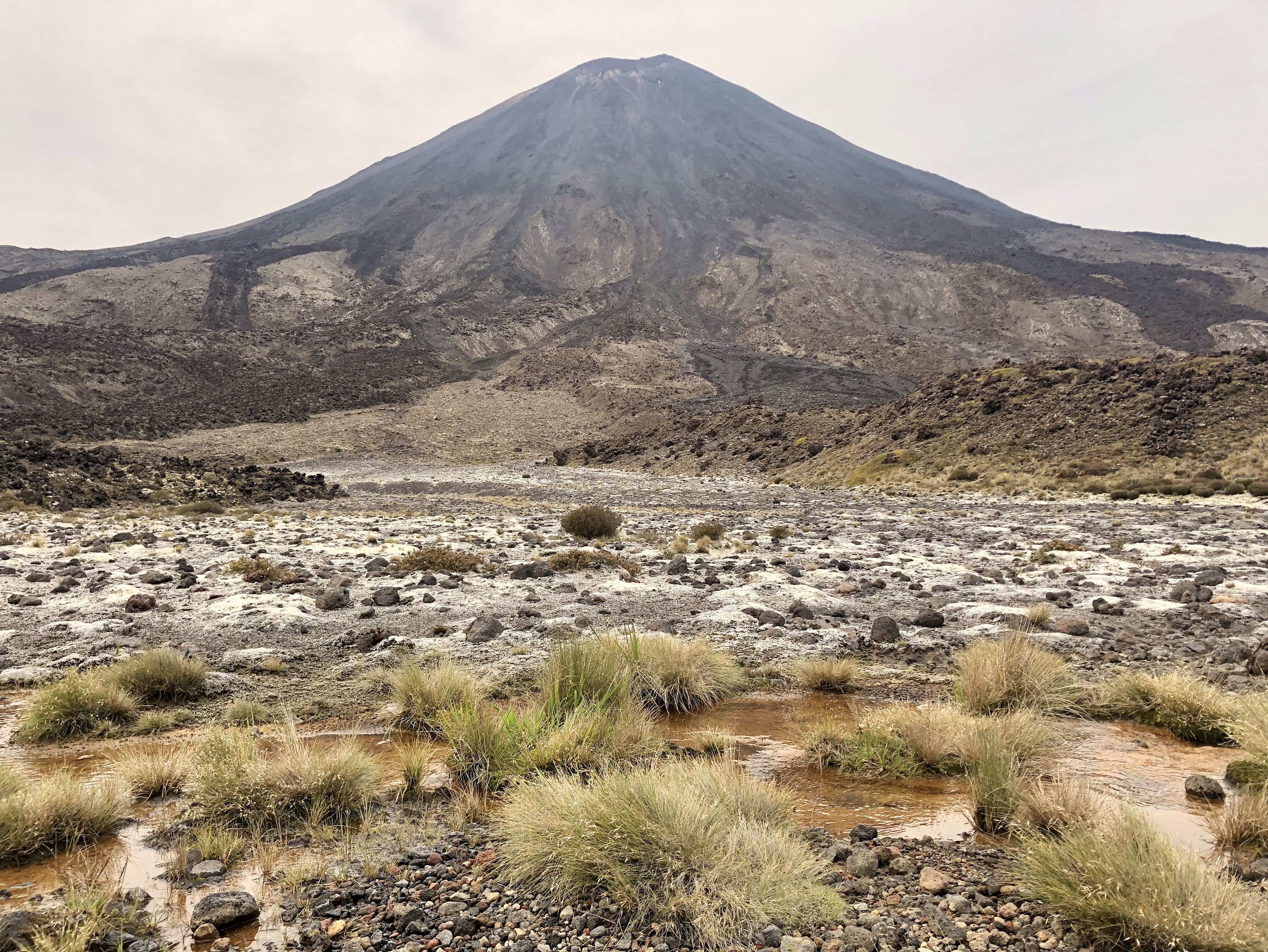
Since the trail isn’t a loop, we parked in a nearby village and arranged for a shuttle to take us to the trailhead and then pick us up and bring us back at the end. We got to the trailhead at 9:30am and saw the ominous black cone rising in the distance. Off we went!


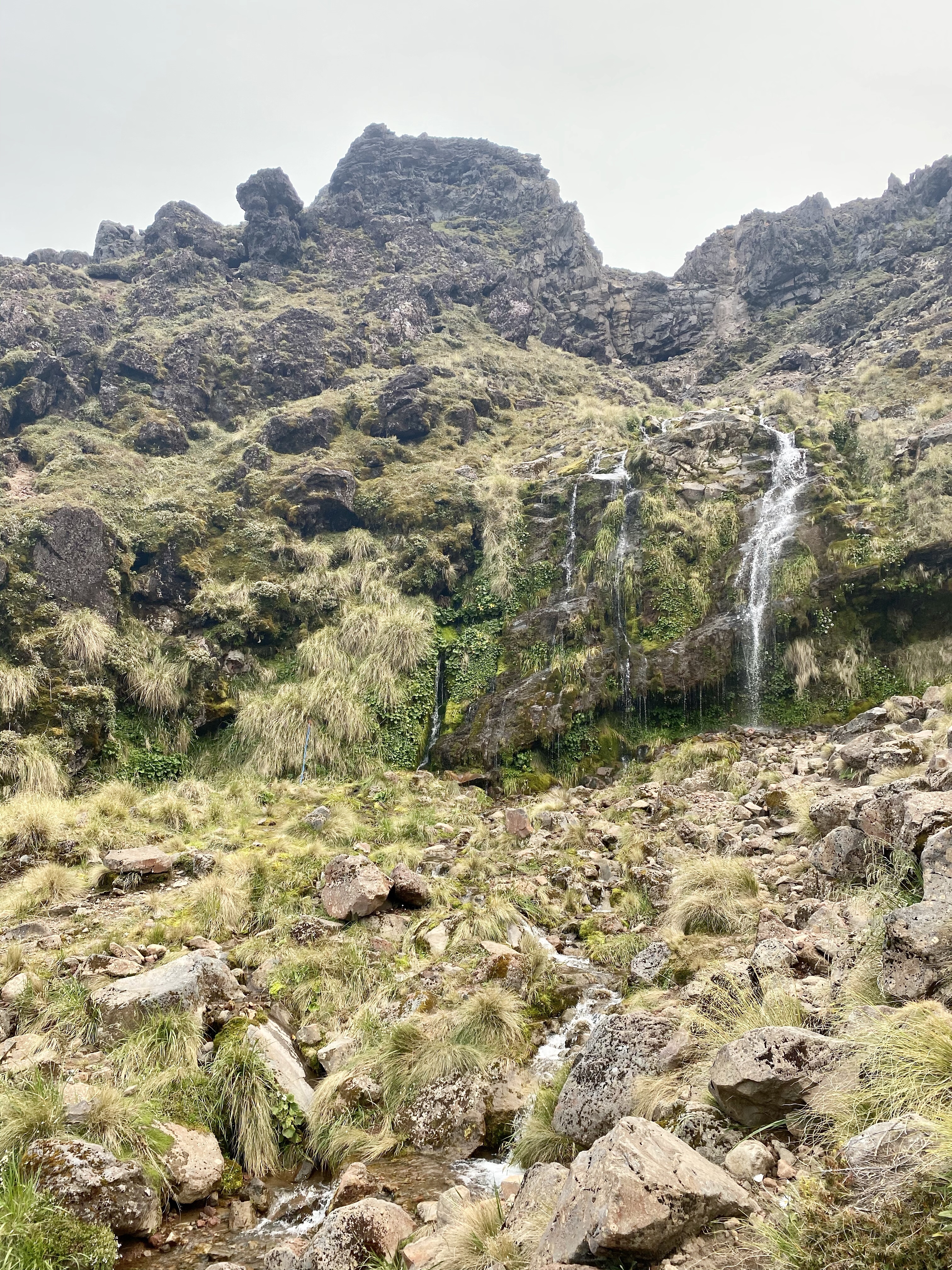
A gentle climb brought us to Soda Springs, a small waterfall at the foot of the mountain. Not exactly lush, but the closest thing to it on this side of the mountain.
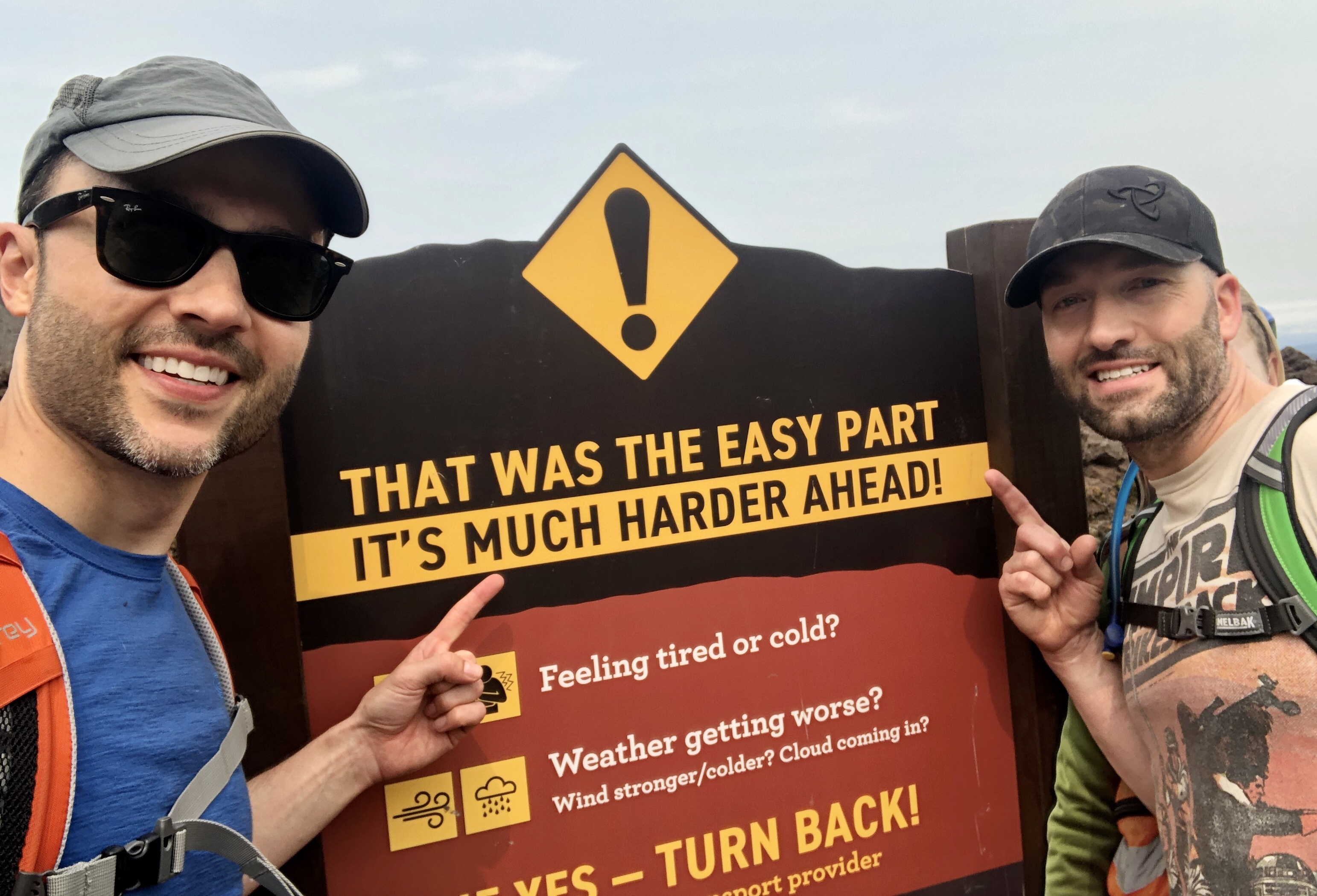
According to the signs, things were about to get a lot harder! We did not turn back…
We crossed a flat lava-filled valley that felt like a moonscape and my have been a volcanic crater…

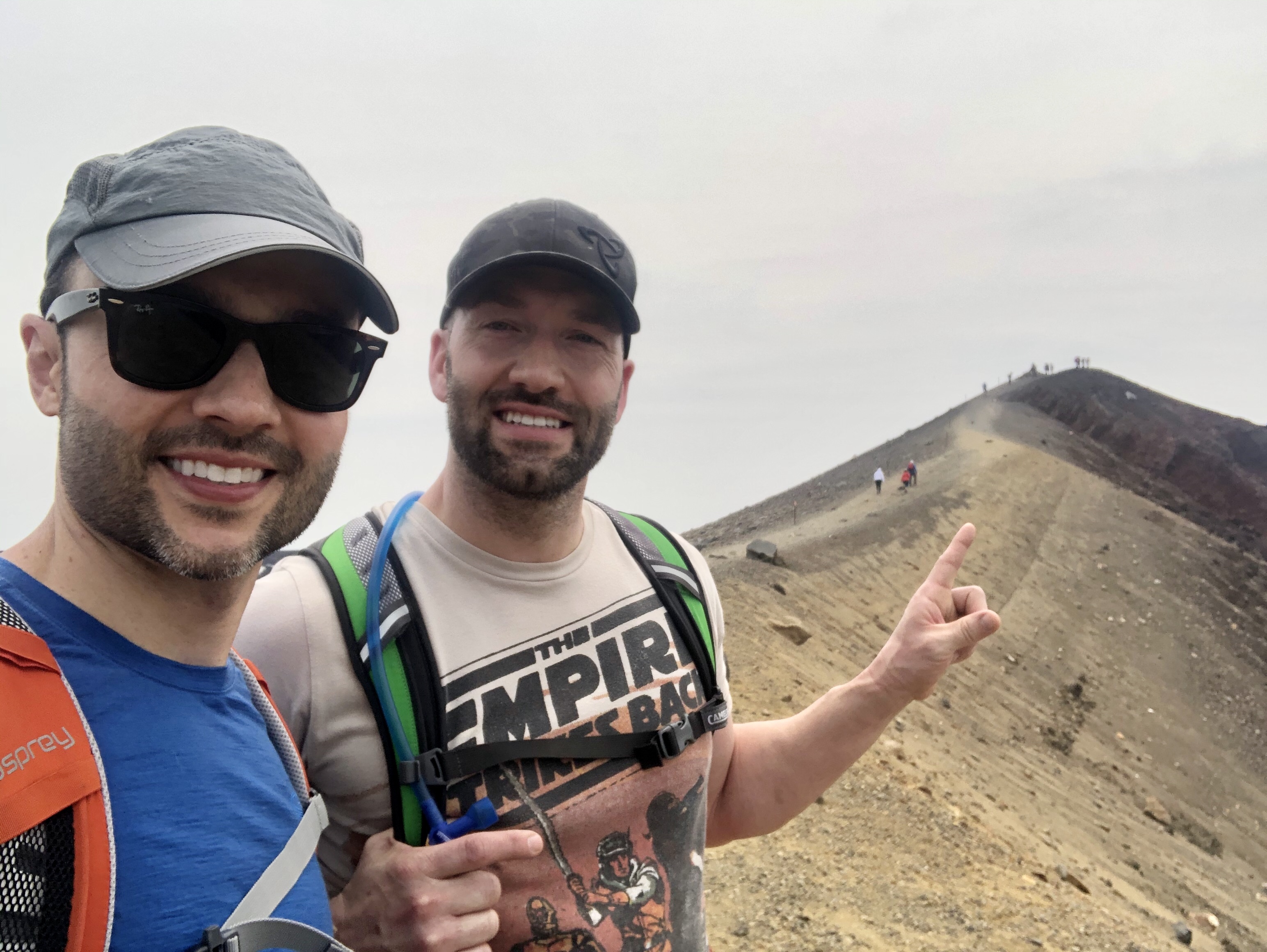
…and came to a ridge where we stopped for a photo…

…and looked back at the spectacular cone behind us…

…and forward at the chasm opening before us.

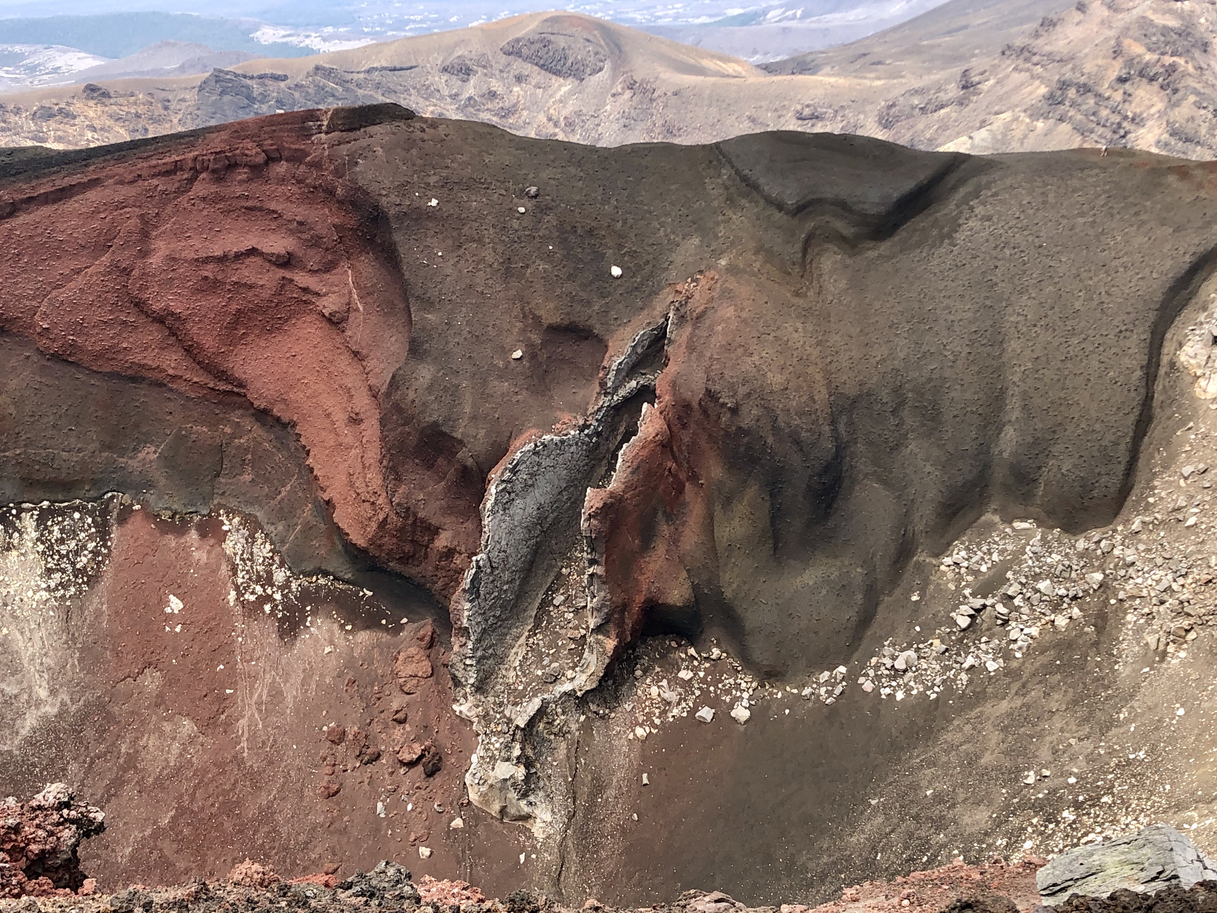
The trail ran along the top of the crater’s edge…
…and swung us around to where we could glimpse the aptly named Emerald Lakes.
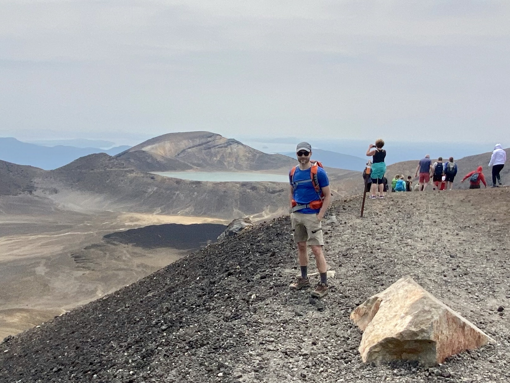

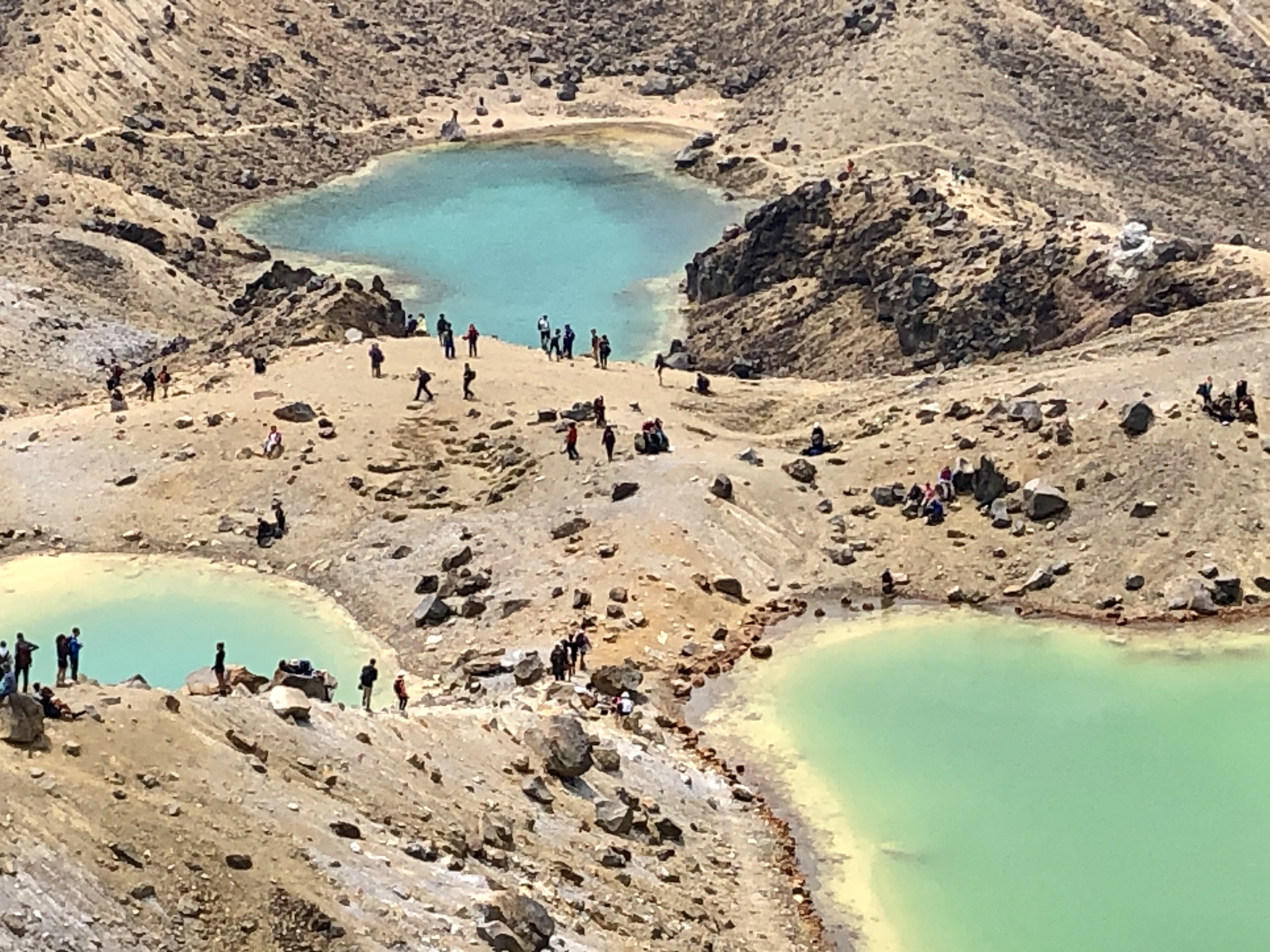

We clambered down a scree slope and found a spot by the lakes to empty our boots of all the gravel, and then to have some lunch. As we moved away from the lakes, we looked back on a view of the major cones marching away into the distance. Such a bleak and dramatic landscape!

Then onward over another ridge and onto the backside of the range. These north-facing slopes were dramatically different from what we had seen so far. Much softer-looking and covered in vegetation that got more and more lush as we descended. By the time we got to the bottom, we had dropped nearly 1,200 vertical feet below the original trailhead! It was jungly and a completely different climate.


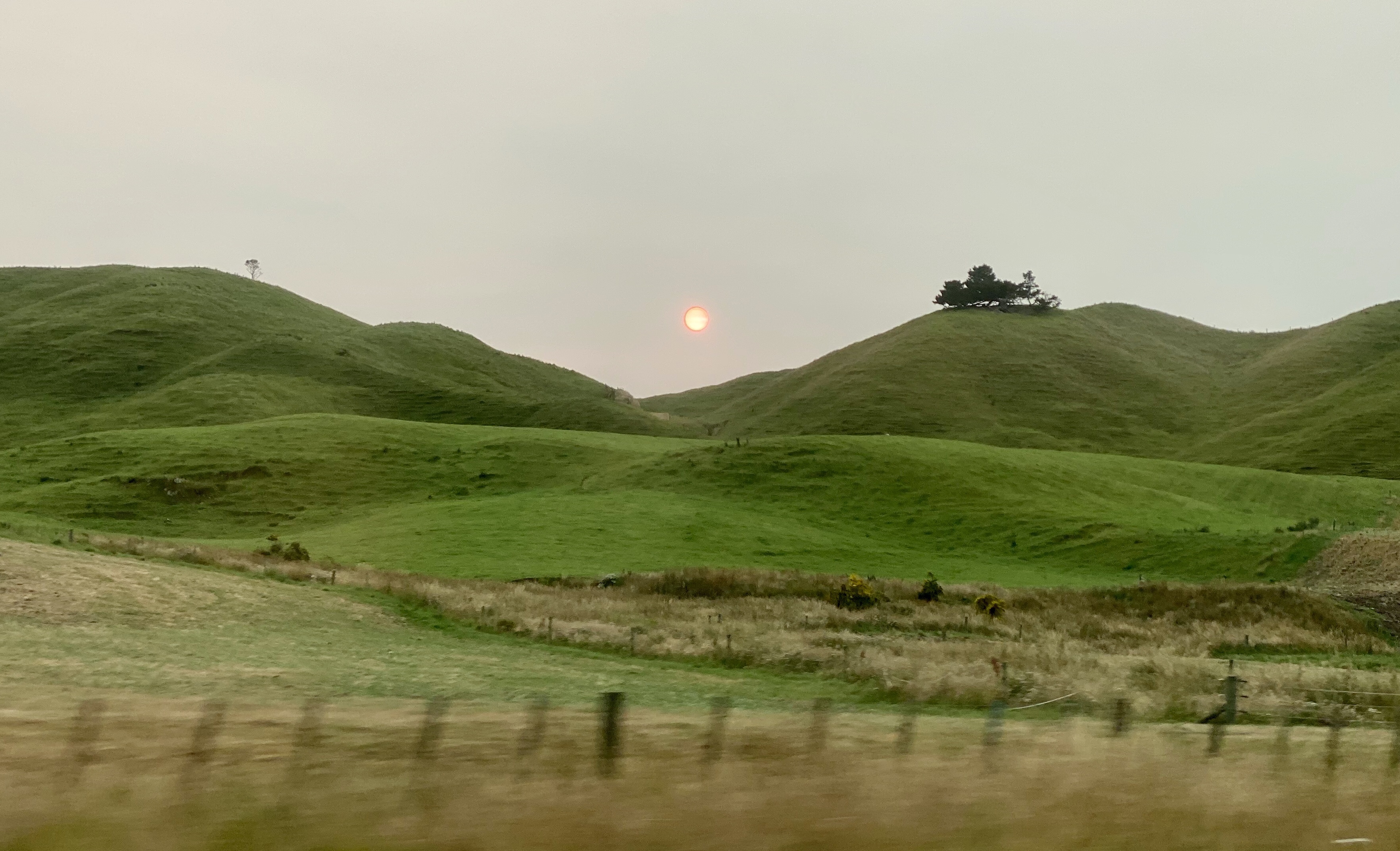
We got to the end without incident and, miraculously, without getting sore knees! The shuttle took us back to our car and we headed home. Along the way we stopped for a scenic viewpoint…
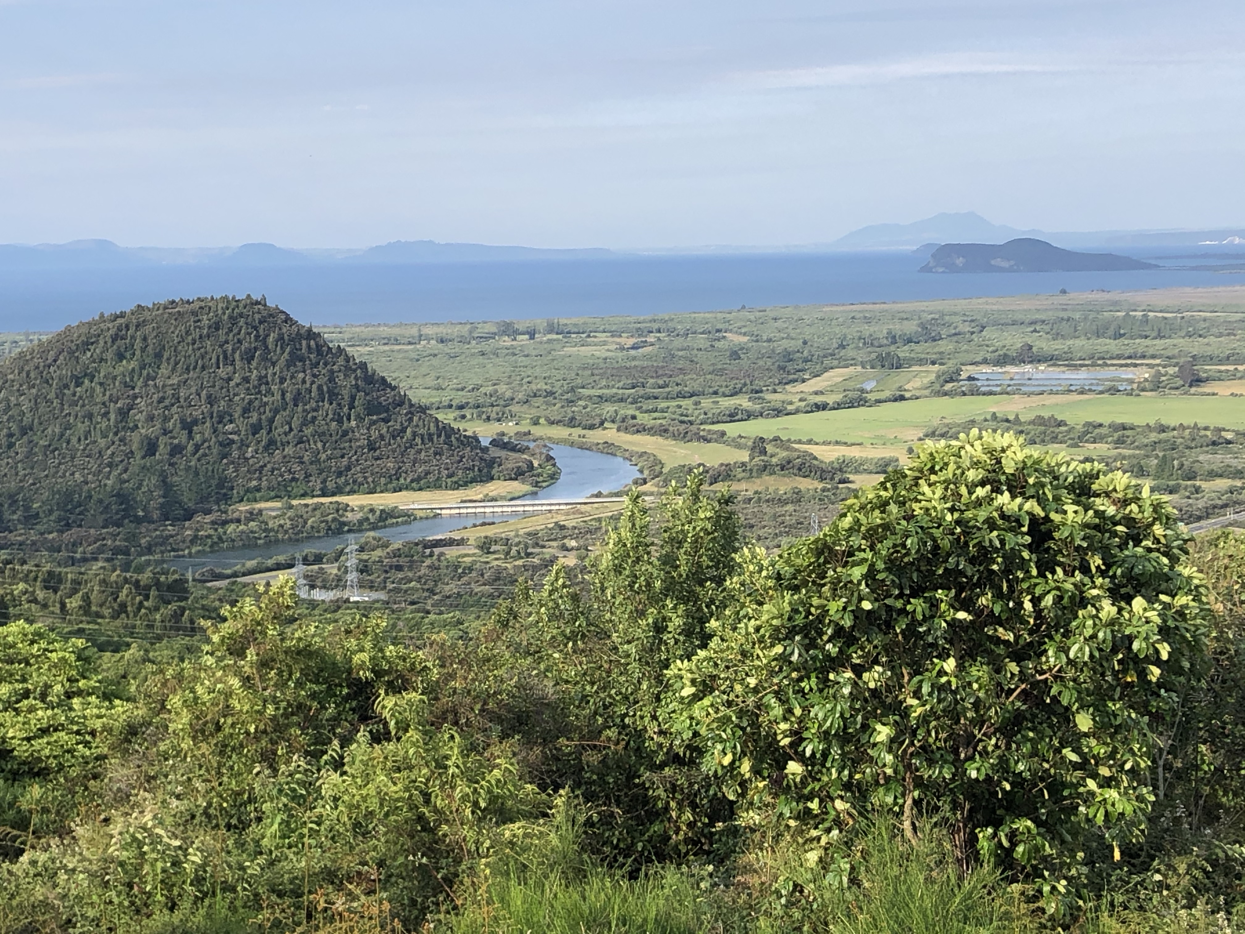
…and some dinner at a dive hole-in-the-wall in one of the small towns near Taupo on the way back to Rotorua.

The drive was excellent. We were tired from the hike but had good conversation and the countryside was bathed in the golden light of the setting sun. Everything that has been hidden by the fog in the morning was now clear to be seen, and oh it was so lovely! It reminded me of the English countryside, with its soft rolling green hills, only the outlandish shapes of the volcanic topography made it feel as though we had gone through the looking glass into some fantastical other world.
